Booking a Topographical Survey: Everything You Need to Know

Topographical Survey Overview
Often called contour surveys, detail surveys, terrain surveys, topographic surveys or topo surveys, topographical surveys are laser-measured land surveys that gather a comprehensive overview of accurate data about natural and man-made features on your proposed site with high accuracy, including the topography and elevation of your land.
A topographical survey will also precisely locate all salient land features such as drainage ditches, existing buildings, service cover positions, site and spot levels, site boundaries, site sections, trees and tree positions, and walkways. We normally present this data digitally and in CAD format to formulate an accurate depiction and clear indication of the land with all site features outlined, as well as any features that are adjacent to the site.
Benefits of a Topographic Survey
Investing in your development is complex, and incorporating certain components will contribute to a successful end result. Through a quick and accurate topographic survey, you can significantly decrease the level of risk.
The additional information gathered from a topographical survey gives you, your planning team and the local authority the insights needed about the land you are looking to build on. As with many circumstances, knowledge is power, so having not only the correct information but the correct information early will benefit your project in numerous ways.
Other benefits of topographical surveys for planning projects include:
- Giving a full picture of the land, including off-site and near-site land features that have the potential to constrain the development or present engineering difficulties, enabling more robust design work and affording some visibility of the most suitable construction methods.
- Reducing the risk of costly mistakes caused by otherwise unforeseen or unidentified issues.
- Saving you time and money by providing the design team and any involved consultants with additional information about constraints – such as the defined boundary, site levels, spot levels and trees – at an early stage.
In simple terms, a topographical survey protects you from unforeseen issues with the specific area of land, your site or your plans that you may have otherwise been unaware of. Additionally, an early topographic land survey will help you to refine your designs and adjust your plans, helping you to save considerable time and reduce cost while avoiding delays and disappointment.
The different types of information retrieved from a topographical survey can have a material impact on your development. For instance, it could make you aware of a need for additional surveys – such as tree surveys – well in advance of you submitting your planning application, thereby avoiding the risk of delay when the local authority inevitably asks for one.
Likewise, if there are unstable ground surfaces, the spatial information from a topographic survey can change how you approach drainage details, the choice of foundation, or even the design itself.
How Will Topographic Surveys Benefit My Development?
By bringing together a selection of fixed points of data in three dimensions and displaying them as easily digestible maps, models and charts, a topographic survey will help you to avoid the avoidable and exploit the exploitable.
Topographical land surveys will enable you to:
- Avoid encroaching on or building over boundary lines.
- Choose the right location for any new buildings.
- Consider re-positioning existing boundaries.
- Discover natural topographic features that could indicate a need for further surveys to get through planning.
- Factor in features on the existing site such as area boundary lines, buildings, structures, the land registry and the national grid system.
- Find opportunities to enhance the value of your development.
- Mitigate the risk posed by natural features like streams, slopes and soil.
- Outline information regarding drainage schemes.
- Pick the best position and face for any proposed structures.
- Take into account off-site or near-site risks that could pose engineering challenges.
- Uncover unseen hazards like the buried foundations of existing buildings.
Although the list above only highlights a few of the practical benefits of booking this type of assessment on your site, in the majority of cases, the pros of getting a topographical survey outweigh the risks of costly mistakes caused by not getting one.
In development or construction projects, your time and money are at stake, so seeing the full picture of your site and all present potential construction difficulties will help reduce the risk of various elements going wrong later in the process.
Do I Need a Topographical Survey?
Every development presents different planning and design challenges, and this means that, unfortunately, there is no one-size-fits-all answer. What we can say, however, is that the larger or more complex your development, the greater the likely need for a topographical survey, particularly if the site is developed and could be housing hidden features.
If your plans are wide-ranging and involve multiple builds spread out over a large brownfield site, for example, the chances of you encountering something potentially problematic are fairly high. That said, you could just as easily run into difficulties partway through building if, for example, it turns out that the ground heights of your open terrain site are more sloped than you thought they were.
Ultimately, determining the need for topo surveys is a question of risk, and it is important to stress that you don’t know what you don’t know. Therefore, it is perhaps helpful to view your topographical survey as an investment, as it will act as an opportunity for land surveyors to tell you everything you need to know about the area of land you are planning to build on, helping you to make all the right decisions.
What Happens if I Don’t Get a Topographical Survey?
If you are in need of a topographical survey and don’t get one conducted on your development site, the consequences could include any number of issues, ranging from relatively minor to profound and catastrophic.
Minor and Major Unforeseen Issues
In terms of the less serious end of the spectrum, issues could involve boundary issues that could lead the local authority to refuse planning permission in the first instance. While this is inconvenient, it is not the end of the world and another application for planning consent can be put forward once the necessary adjustments have been made.
Looking at the more serious end of the spectrum, building too close to a retaining wall could cause a total structural collapse. But as you aren’t an expert in construction, you won’t know exactly what ‘too close’ is classed as without the level of detail brought to light from topographical surveys.
A concerning factor about any land and property development is that a lot of the unforeseen issues a land survey will uncover aren’t immediately apparent during the building process. In fact, unless it is something dramatic like a 20% incline or a signposted disused mineshaft, things can appear completely normal. As such, if you take a risk by not getting a topographical survey, you could face further costs and delays caused by this decision months or even years after your development or construction projects are finished.
Optimising Your Project
Though not as frustrating as a refused planning condition or as dramatic as a collapsed building, there are other consequences of ignoring the need for a topographical survey, such as missing out on opportunities for your site and project. Although it can be sensible to approach development in a risk-averse manner, lacking the insights from a topographical survey could lead you to limit your aspirations due to a lack of knowledge on the man-made and natural topographic features on your site to such an extent that the development suffers or doesn’t reach its fullest potential.
As well as showing you what you can’t do, land surveys will also show you what you can do. Land surveys aren’t only there to warn you of danger; they will also utilise detailed information from your entire site to give you and your planning team the necessary assurances, helping you to explore development opportunities you may have initially dismissed as unworkable.
From design to completion, a topographical land survey will be the sound foundation you need to see all site features on your area of land. You can get some small, domestic designs through planning without one, but if you want to make the most of your development and get planning consent without getting dragged through the mire of rejections and committees, it would be wise to consider a topographic survey.

Process of Conducting a Topographic Survey
After booking an assessment, the process of undertaking a topographic survey is relatively straightforward, following a similar format to other building and land surveys such as a 3D survey, condition report, measured survey, utility survey or visual impact assessment.
It all starts with a discussion where we will ask you about your site, what you want to achieve, and how you are currently planning to go about it. From there, we will be able to use your needs to help determine the level of detail your land survey will need to go into.
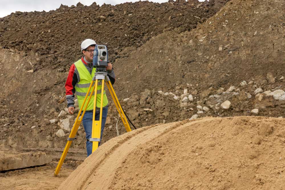
One or more of our experts will then visit your site and set up highly specialised survey equipment to carry out the survey. Common tools used for topo surveys include cameras, accurate GPS equipment and other GPS devices, laser scanning instruments, site levels, and total stations. With the necessary survey equipment, the land surveyor will capture the exact best-fit measurements and other data such as datum information, and create an accurate picture of the map of your site.
The difficulty of the survey will be dependent on the nature of the site. In some cases, the site may be hard – or even impossible – to fully cover on foot. Different types of natural features on the site can act as obstacles, such as offshore islands, steep inclines, ravines or simply the physical geography of the area. Manmade features can also pose a hindrance to the survey, such as busy roads, existing buildings, partially collapsed structures or power stations. If it is too difficult to reach certain areas of the site, the land surveyor will use other forms of highly specialised survey equipment such as drones that can be used for taking photographs or laser scanning.
Other information may be retrieved before or after the site visit using other means, such as from an ordnance survey or records from the local authority. Most of the topographical land survey works we do are to facilitate design-stage activity. This is because your architect and/or design team will need CAD drawings and pinpoint-accurate land measurements to create feasible plans.
The gathered data can then be used by your land surveyor to create accurate drawings using point cloud technology (also sent to you as a PDF). Topographic features on the accurate picture may be displayed as:
- 2D drawings that resemble conventional maps
- 3D models

Why Work With Arbtech?
For years, Arbtech has been providing no-nonsense, fast, efficient and affordable surveys to different types of private and professional clients across the country. We possess an unmatched level of experience in our field, and our unique business model allows the majority of our land surveyors to be home-based and situated in various locations all over the UK. Using this format, we can reduce our overheads and pass our savings on to you.
Our land surveyors boast expertise in numerous areas to meet the specific needs of our clients, reducing the likelihood of costly errors occurring at any stage in the development process. With a mix of vastly experienced professionals and exciting fresh talent, we work hard to attract the best people in the business, with the primary reason being that it gives our clients a top-quality service from a friendly team of experts who love what they do.
How We Work
Our team undertakes topographic surveys on a wide range of sites all over the UK in partnership with sister company, TSH. Covering residential, commercial and industrial developments, TSH works predominantly on urban, green and brownfield sites, as well as mills, quarries, wildlife reserves and everything in between, and alongside topographical land surveys, also provides measured survey, condition report, utility mapping, visual impact assessment and 3D survey services.
With input from TSH, we are capable of carrying out topographical surveys over any accessible area. We can provide them at any scale or level of detail. Land surveys commonly need to be tailored to the specific needs of the project and client, so the best place to start would be to get in touch and provide us with details of your development or construction projects.
What Makes Us Different?
A key component in the foundations of any property or land development, topographical surveys require a trusted team that can develop an image that incorporates all man-made and natural topographic features on your site.
Throughout our time in business, we have worked with a vast array of clients including architects, building contractors, developers, engineers, estate managers and homeowners. Not only that, but many of our existing clients come back to Arbtech for all future projects because they know they will get outstanding customer service and high-quality work every single time.
Our proven track record and years of experience mean that we have seen just about every requirement you could think of, and as a result, we have a solution for every kind of project. If you would like to find out exactly what our customers think, just head over to our reviews page, or read an example review from a client just like you below:

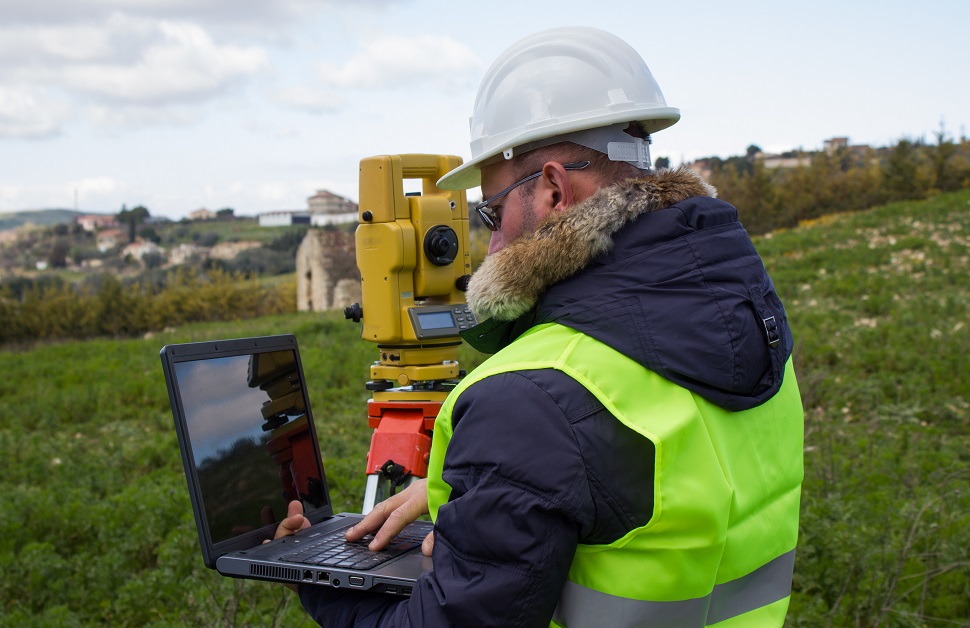
Total stations are a form of laser scanning equipment used on topographic surveys.
Why Choose Arbtech?
Since we started carrying out surveys, we have grown a reputation for quick yet effective and professional services, delivering thousands of successful projects per year, and resulting in hundreds of genuine five-star reviews from our topographical surveys and various other survey works.
Each of our land surveyors takes the time to understand your requirements and answer any and all questions you have in plain English, removing unnecessary lingo and jargon. All of these factors come together to give you a detailed topographical land survey cheaper and faster than pretty much anyone else.
Starting Your Topographical Survey
Taking the first step in booking a topographic survey on your site is really simple. Just get in touch with us by speaking to our friendly team and we can ask you for your details before producing a no-obligation quote based on your specifications.
You can do this by calling us using the number at the top of this page, filling out our quote form or via our other communication options on our contact page. We will then send across a free quote and if you are happy to move forward, send it back and we can arrange a suitable time to visit your site.
Where Do We Cover?
Currently, Arbtech has offices located in Chester, Birmingham and London, allowing us to spread out our range across the country in the North, Midlands and South, all while enabling our team the ability to cost-effectively cover most of the mainland United Kingdom. That said, we aren’t opposed to covering clients that need a topographic survey in other areas.
For instance, in some circumstances, we have carried out assessments in Jersey, Guernsey, the Isle of Man, the Isle of Wight, Northern Ireland, the Republic of Ireland, and even Italy. All we ask is that clients get in touch and tell us the details of their project and the location of their site. We can then let them know how much it will cost, locate the land surveyor closest to the location in question, and choose a date to get the process started.
Get Your Free Quote for Topographic Surveys
If you want to book a topographic survey or require advice on the most suitable form of assessment for your development site, speak to Arbtech and our helpful team can point you in the right direction and provide you with a one-page survey booking form. Assuming you are happy with your quote, return it back to us and we can allocate a project manager to you.
With their experience, knowledge and qualifications, the topographic survey experts will produce a CAD format image with all natural and man-made features highlighted, simplifying the process of putting forward an application for a planning condition, eliminating the risk of costly and time-consuming mistakes, and producing the insight required for you to find every potential opportunity from your development.

