Last updated: July 2026

Author: Rob Lambert
Editor at Arbtech, Rob is a content specialist who manages our ecology and arboriculture services copy to ensure it is accurate, up to date, and insightful for current and future clients.
BS5837 tree surveys and tree constraints plan (TCP) drawings are required for most planning applications where trees are on or adjacent to your site.
For a free quote on your site, reach out to the team at Arbtech today.

Last updated: July 2026
Editor at Arbtech, Rob is a content specialist who manages our ecology and arboriculture services copy to ensure it is accurate, up to date, and insightful for current and future clients.
Getting your planning application approved and meeting all planning requirements often hinges on a professional BS5837 tree survey.
We help you navigate this requirement by providing a detailed overview of the exact reports and mapping that your local council needs to see.
By identifying Root Protection Areas and categorising tree health early, we ensure your architect has a clear “developable area,” reducing the risk of redesigns or application refusals.
We focus on speed and certainty to keep your project moving. Our expert surveyors visit your site quickly and deliver fixed-price, comprehensive reports that satisfy British Standards.
We provide practical advice on tree retention and protection measures, ensuring you meet all legal obligations while maximising the potential of your development site.
For a free quote, contact our team today.
Existing trees on a development site can cause issues in relation to design, demolition and construction work.
To ensure that construction activity does not negatively affect retained trees and go against the UK planning system, a thorough assessment must evaluate the specific site conditions before any work begins on new developments.
If you’re set to undertake a property or land development project where trees that are directly present or in close proximity could be impacted negatively by your planned works, moving ahead without consideration is only likely to result in penalties, fines, delays and planning refusal.
Evaluating tree health and the overlap between a planning project and nearby trees will help to solidify a harmonious and sustainable relationship between the two factors.
Developers are advised to book a British Standard BS5837 Tree Survey, as it will prevent impending legal issues, all sorts of potential problems throughout the construction phase, and otherwise present health and safety concerns.
The BS5837:2012 tree survey is common in planning and appears as the immediate response to confirming whether any constraints are likely to occur between trees and the project.
Once an assessment has been completed, the developer will be able to move forward knowing if any trees are under existing protection, such as a tree preservation order (TPO) or if the site sits within designated conservation areas.
With this information, the developer will be able to align their development layout with the local planning authority requirements. An arboricultural consultant can gauge the necessary steps for the plans to move forward, alongside assurances over the planning application.
Every local council has a tree officer responsible for weighing the council’s policies on tree management against your development ambitions and providing a recommendation to your case officer regarding the decision to grant or refuse planning permission.
At this point, the tree survey results will be used to support the decision following an arboricultural consultant’s efforts to account for tree retention, removal or demolition and compensation as necessary.
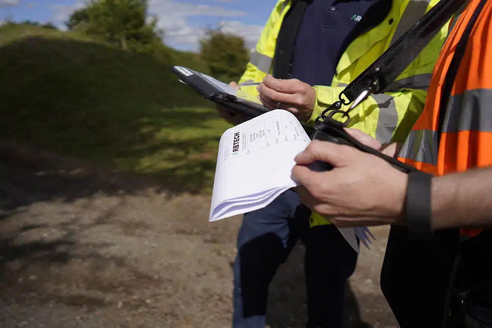
In simple terms, a BS5837 survey will see an arboriculturist attending a development site and reviewing all trees in the local vicinity.
Each tree will be branded with a predetermined category to indicate the current condition of the tree, confirm the physiological and structural condition, and decide the most suitable outcome for it.
Our surveyors evaluate features like age class, structural integrity, and life expectancy to calculate the influencing distance of roots and canopy in relation to existing structures and any proposed development.
An assessment above and under the ground will help to establish the value and species of every tree, as well as such details as the canopy cover, crown spread, tree roots and root protection area.
By using the Trimble® Juno handheld (Global Positioning System) location device and PT-Mapper Professional, an arboricultural surveyor can store extensive information about each tree including spatial information. Trees can be plotted accurately onto a topographical survey map or ordnance survey map.
As well as enabling a developer to work out the next steps for trees on site, the completed BS5837 will prove to a local authority that laws surrounding trees have been adhered to.
Upon completion of BS5837 surveys, the tree consultant in charge of the assessment process will put together an arboricultural report.
The purpose of BS5837 reports is to display the results from the inspection and the grading for each tree alongside evidence that it is possible to continue the development and grant planning consent provided the developer follows their instructions.
The local planning authority will be accepting of the project as long as the BS5837 report has been able to demonstrate protection of the high-quality trees on site; that measures are in place to correctly relocate any trees disrupted by the scheme and that dead, dying or poor quality trees that present a health and safety issues will be felled, with new trees planted in compensation.
If any additional information is needed to support the BS5837 tree report such as an arboricultural method statement (AMS), arboricultural impact assessment (AIA) or Tree Protection Plan (TPP), the tree surveyor can either include these in the report or conduct further surveys at a later date.
The report can also recommend the use of other assessments. Getting professional advice early in the design process prevents avoidable planning delays and ensures your development proposal satisfies strict planning conditions down the line.
Another component in a tree report is a Tree Constraints Plan (TCP) to set out all trees using an accurate map of the site, supplied to clients in AutoCAD and PDF format.
A client’s architect or design team has the ability to overlay the BS5837 drawing across existing plans and drawings of the development site, making it easier to see where trees appear, the intentions for each tree, and how the presence of trees could overlap with the aims of the project.

As previously mentioned, a grading system establishes the trees to be retained, relocated or destroyed. An overall value and score is achieved according to tree health, size, lifespan and amenity value using the BS5837 categorisation table.
Category A Trees
Category B Trees
Category C Trees
Category U Trees
A surveyor assesses each tree for potential issues above and under the ground. A tree canopy can be easily protected by simply installing protective fencing like a Heras protective fence around the tree, along with signage warning drivers of machinery to stay clear.
It helps to maintain the overall retention value of the specimen and protects the local environment throughout all ongoing construction activities.
To protect trees below ground, a root protection area calculation will establish the rooting area needed by a tree to survive.
A root protection area is calculated by working out the radius of the area around the tree, with the tree sitting at the centre of a circle. The diameter of the stem at 1.5 metres above ground will then be recorded and multiplied by a factor of 12: other metrics are available for multi-stemmed trees.
For example, if a tree had a stem diameter of 0.5 metres, the developer would need to avoid disturbing the ground around the tree by up to six metres away.
That said, it doesn’t mean any intervention with the ground surrounding the tree is strictly forbidden, as certain activities could be worth carrying out anyway. Any practices that could harm roots will be scrutinised because they need to respire at a cellular level and require oxygen to survive.
Most tree roots are in the top 600 millimetres of soil and barely any go down more than a metre, leaving them spread out in a network across a wide area that is sensitive to compaction.
It is easy to instruct our team to conduct an initial survey on tree quality. As a BS5837 tree survey will play a significant role in your planning process, you will want to understand the cost, consultants and booking details involved in completing the inspection.
In the section below, we’ve explained key information surrounding BS5837 tree surveys:
Depending on the number of trees on the development site, the BS5837 tree survey cost will vary from client to client. Other factors that could affect the price include the size of the site, the location and the availability of our tree surveyors.
We make our pricing fair by starting the BS5837 cost at £349 and only adding on what we need to. Operating in this way prevents anyone from paying more than they need to, especially in the case of developers on small sites with minimal tree numbers.
Our fully qualified tree consultants are able to provide you with arboricultural impact assessment and arboricultural method statement details, as well as any other information, including a reliable proposed list of the trees retained, relocated and destroyed on your site.
Using our design, demolition and construction recommendations for trees in relation to planning, we’ve been able to support countless projects and help to obtain planning permission for numerous clients.
From air spading for uncovering roots to tree climbing and grading trees in suitable categories to assisting with other planning matters on any site that contains trees, we can step in to help with any and all problems you may have.
The BS5837 consultants in our ranks are all qualified, educated, licensed and capable, and following collective years of experience working alongside commercial clients and private developers up and down the country, we are able to lead a BS5837 tree survey on your site.
Developers commonly use a BS5837:2012 tree survey as a way of breaking down tree quality across a site and deciding which trees will remain on the site, move elsewhere or be destroyed and compensated with the planting of new trees.
If there are trees on your site, it would be worth reaching out to Arbtech and booking a tree survey to ensure that none of your trees are protected and nothing you are planning could cause harm to them.
Remain in line with the BS5837 tree survey requirements by speaking to our team and requesting a quote. Either call our administration team directly over the phone, email us or fill out an online quote form on our contact page.
You will then be given a free quote based on your details, and if you want to move forward, we will be more than happy to arrange a date and time to attend your site and help with your planning application.
If our dedicated page on BS5837 tree surveys didn’t give you the answers you need, check out the common questions below or get in touch with our team directly.

Arbtech are your best asset when it comes to getting planning permission for your project. We cover the whole of the UK and we are waiting to get started on your project...
Get Your Free Quote