3D Laser Scanning Surveys
From extensions to renovations and everything in between, all new development projects demand precision. If you decide to rely on old paper plans or manual measurements, you introduce serious risks into your plans, and the assumptions that your information is correct could lead to errors, delays and unexpected additional project costs.
Without highly accurate data, your next project could stall, as construction projects are likely to experience issues from the architectural plans not corresponding to the reality of the site’s current dimensions. By relying on 3D survey services, we can guarantee that clients get an accurate representation of the site based on the condition during the planned works.
After delivering accurate and verifiable site information from 3D laser scanning surveys, we can record the dimensions of existing buildings, help your project run smoothly and even go as far as to conduct other building or land surveys if they are needed to support your development.
What is a 3D Laser Scanning Survey?
Known by many similar names – such as a 3D laser scanning survey, a 3D laser survey scan, a 3D building survey, a 3D scanner survey or a 3D scanning survey, a 3D survey is essentially digital photography, except measurements are included.
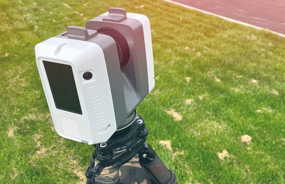
A non-contact method of measuring a structure or piece of land, 3D building surveys involve an easy-to-understand method that uses specialised laser scanning equipment to reality-capture detailed information about an area.
More specifically, LiDAR (Light Detection and Ranging) technology is used to generate accurate 3D point cloud data, with a laser scanner rapidly firing laser beams to measure the distance to every surface it hits, including roofs, trees, walls and any other features.
With 3D laser surveys, the process is extremely fast, collecting a million points of data every second, resulting in laser scan data formed from a dense cloud of dots. The 3D point cloud will be the most accurate data of your site, and with it, a building surveyor can turn the readings into precise drawings.
Why Might Someone Need 3D Laser Surveys?
It is common for 3D laser building surveys to be used to ensure high accuracy, save money and mitigate risks on any complex project.
Our team can refer you to a sister company for services that offer a wide range of benefits for architects, engineers and property owners, such as:
Minimising the Likelihood of Reworks
The accurate measurements and reliable results prevent expensive errors during the design and build phases.
Saving Time and Money
The laser scan data gives you a permanent digital record, removing any need for costly and time-consuming return visits to inspect the site additional times and gather missed dimensions.
Prioritising Health Safety
The approach we take means we capture data efficiently and remotely, covering hard-to-reach, high-level or potentially hazardous areas.
Unearthing Comprehensive Data
The insight a building survey gathers captures every component of the site to provide accurate and reliable results, and it could even help with other future services, like measured building surveys or the creation of detailed flood plans and drainage plans
3D Scanner Surveying
As a result of 3D surveying, we can provide you with a full measured survey service that is completed with speed and exceptional accuracy.
For more information on how we carry out 3D surveys, what equipment we use and the software we utilise for processing the data, check out the details below.
Methodology for 3D Surveys
Our approach follows a clear and efficient process to deliver high-quality results:
1. Strategy and Detail
Speaking to you directly to discuss your needs and determine the correct level of detail (LOD).
After in-depth conversations with you, our experienced team ensures that we gather the exact information you need, whether you need help with floor plans or advanced 3D BIM (Building Information Modelling).
2. On-Site Data Collection
Undertaking a site survey to capture data efficiently in a fast and non-intrusive way.
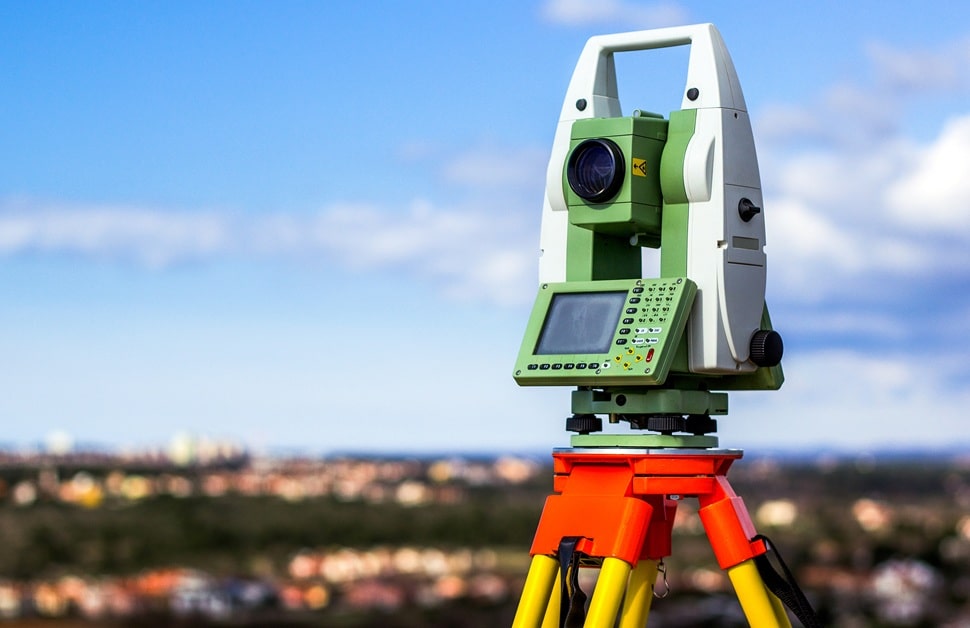
Laser scanning equipment will be vital, as well as a total station and GPS equipment to link all measurements to a professional land coordinate system.
3. Data Processing
Formatting the massive volume of scan data.
Specialised photogrammetry software aligns all the separate scans into one unified point cloud data file.
4. Final Deliverables
Formatting the raw data into easy-to-use outputs.
The 3D survey data taken from the visit could include cross-sections, contour lines, detailed drawings or Revit models.
3D Laser Scanning Survey Equipment
We rely on advanced technology to maintain millimetre-level precision and high quality, selecting the ideal tool for the job every time we are instructed to collect 3D survey data.
In terms of the types of 3D building survey equipment we use, common examples include:
- 3D Laser Scanner – used to collect a million points of accurate measurements per second
- Total Station – used to accurately set out and reference control points
- GPS Equipment – used to ensure that all data is tied to a professional land coordinate system
- HD Camera – used to colourise the 3D point cloud, adding visual context to the results
Not only that, but if we need to incorporate other surveys, we may require additional tools, such as ground penetrating radar (GPR) in utility mapping or other GPR surveys.
3D Survey Software
Once the raw data is collected from the site, our skilled technicians use industry-leading 3D survey software to turn the massive point clouds into usable plans:
- Geospatial Processing Software – used for aligning all the raw laser scan data files
- AutoCAD Software – used for creating the final 2D detailed models, such as detailed floor plans and internal and external elevations
- Revit Software – used for producing 3D outputs, including detailed 3D models for civil engineering and project management

Choose 3D Laser Scanner Surveying with Arbtech
Offering a seemingly endless list of services to clients all over the country – such as ecology survey, tree survey and measured building survey services – Arbtech is the right solution for supporting your planning needs.
Our commitment is to provide simple, reliable and high-quality 3D laser scanning survey services, along with countless other solutions to help get planning permission over the line and assist in overcoming other obstacles to development work.
If you want more information about how we undertake our 3D laser surveying services, check out the section below, where we talk about our consultants, our fees and our communication options.
How Do 3D Survey Consultants Qualify?
The dedicated team we work with comprises land and building surveyors who hold the necessary accreditations and are experts in laser scanning services.
Whoever you’re given to work on your site, you will get the same required level of attention to detail and someone as qualified, suitable, knowledgeable and effective as anyone else in our partner company’s team.
Like with Arbtech, the company we rely on for building surveys works as a cohesive unit, collaborating with other professionals to ensure that you get the exact data needed for your planning application.
How Much on Average Does 3D Laser Surveying Cost?
The cost of 3D laser surveying is bespoke and based entirely on the complexity and scale of the site in question.
Planning projects involving a basic structure on a small site requires less time and fewer points of data, leading to lower project costs. Alternatively, however, larger and more complex buildings that require far more attention and vastly larger amounts of data points will naturally cost more.
You can get an indication of the 3D survey price on your site by speaking to our experienced team directly. If you get in touch, give us key details like your full address and explain the specifications of your proposed development and why you want 3D surveys, and we can give you an accurate fee.
Contact Us for 3D Surveying Services
By calling on Arbtech to help with your development, you’re opting for access to a team of experienced and advanced professionals who possess a proven track record for supporting planning applications, creating materials to help the design stage, and removing any boundaries that would otherwise harm your plans.
The 3D laser scanning services provided by our partners result in advanced 3D models that can contribute to the early stages of your project, with deliverables in the form of a Revit or BIM model. On top of that, if you need additional services for your development, our partner can continue offering assistance with topographical surveys, GPR surveys and countless other options.
If you want a team known for effectively and efficiently helping numerous private and professional individuals and businesses in planning, choose Arbtech. With building surveys, it’s the same situation, but with us acting as a moderator between clients and service providers. Under a calculated approach and with heightened quality control, your 3D survey will give you everything you need. Ask for a free quote by emailing us, calling us or filling out a quote form on our website, and we will push you in the right direction.


