Last updated: June 2026

Author: Rob Lambert
Editor at Arbtech, Rob is a content specialist who manages our ecology and arboriculture services copy to ensure it is accurate, up to date, and insightful for current and future clients.
If there are trees on your development site or you have been directly told that you need a tree survey before you can realistically apply for planning consent, our knowledgeable team are experts in tree work. We offer our services to all of England – including London – with tree reports capable of satisfying the local authorities.

Last updated: June 2026
Editor at Arbtech, Rob is a content specialist who manages our ecology and arboriculture services copy to ensure it is accurate, up to date, and insightful for current and future clients.
The London region is green, and it’s going greener. As you can see from this map, the tree care cover in London is pretty incredible, especially for a major metropolis that is home to almost 10 million people in an area of 607sq miles – differing massively from somewhere like Wales which has three million people across 8,000sq miles. Tree canopy cover extends to an estimated 21% of the city’s total land area, and tree numbers are currently somewhere in the region of 8.4 million trees.
The mayor of London has further committed to increasing the net canopy cover by 10% by 2050. That’s roughly 840,000 new trees planted in the city in 30 years, and that assumes there’s no loss of trees and other vegetation in the meantime. Clearly, in nearly three decades, tens of thousands of trees will need to be felled and replaced as a result of sound arboricultural management recommendations from a qualified tree surveyor.
But, in the same timeframe, a report by National Geographic estimates that London local council will add two million more residents and need to build at least 65,000 new homes a year for thirty years to house them. And all of this needs to be achieved without spilling over into the greenbelt – an area three times the size of London that was originally designed in 1935 to stop the sprawl of the city.
Whoever the next few successive mayors are definitely have their work cut out, balancing the competing interests of environmental responsibility and housing, as it relates to wealth inequality. All of this will compound the existing challenges facing planning applicants where trees – and tree roots that may go undetected – are on or adjacent to their proposed development site.
All parts of England operate within a framework that prevents unnecessary direct or indirect damage from coming to trees, triggered by section 198 of the Town and Country Planning Act 1990. The Act also highlights tree preservation orders (TPOs) as a method of protecting individual trees and conservation areas as a method of protecting groups of trees situated within a named location.
Any development work done on the development site such as design, demolition and construction work where trees under these parameters are present will need prior content of up to six weeks from the local council beforehand. Rather than leaning into potential risks with securing planning consent and compromising existing tree protections – as well as posing health and safety issues to individuals and buildings from any dangerous trees present – architects, developers and project managers should refer to tree surveys for planning projects in all current and future work.
In the majority of cases, the survey carried out with the purpose of producing an arboricultural report to support planning would be a British standard assessment known as a BS5837 tree survey. It is usually delivered to you or your design team at the RIBA Plan of Work stage 0-1 in the form of a brief summary tree report, survey schedule and Tree Constraints Plan (TCP) drawing. The latter is an AutoCAD document that acts as the most important supporting document that we refer to collectively as ‘work stage 1’.
A BS5837 assessment on trees works by allowing for a tree consultant to use their encyclopaedic knowledge of tree species to identify and catalogue trees on or adjacent to the development site including applicable surrounding trees before categorising them under A, B, C or U based on tree health, quality, condition and value. Trees marked under Category C or U will rarely obstruct a development, whereas trees within Category B or A can cause significant changes to the development plans.
On any new development, retention of trees will stand as the priority outcome, but if tree inspections indicate that trees need to be relocated or destroyed, the arboricultural surveyor will provide advice to move trees that are in good condition elsewhere inside or outside the site or compensate for the destruction of trees in poor condition with trees of a similar value. A TCP drawing will then be produced in a .dwg or .dxf format on a base layer like you would find with ordnance survey tiles or topographical survey.
A TCP clearly illustrates above and below-ground constraints to development caused by trees. Canopy spreads are mapped out in the cardinal compass directions and root protection areas, highlighting realistic limitations to root development and other considerations such as level changes that compact from hard surface treatments and severe inclination. The architect or planning agent can then use CAD to overlay the scheme onto the TCP and see where the two conflict, if at all.
From here, if there are no conflicts or any identified conflicts that can easily be managed, it is unlikely that your local planning authority will request anything further. Or, if they do ask for anything further, it’ll be a condition of planning consent as opposed to a factor that could determine the likelihood of a viable application. If, however, the local authority remains unhappy, you will need to move on to the second stage of arboricultural planning support known as ‘work stage 2’.
In order, plans and reports from stage two include:
An AIA drawing shows your tree officer and any potential third-party objectors exactly what and where the trees are and precisely what the level of impact upon them is. The categorisation process undertaken at the earlier tree survey stage allows for judgements to be made regarding impacts on lesser quality trees (C and U category) or losing them altogether and mitigating for impacts on better quality trees (B and C category).
At this stage, it is make or break for your planning application, and if your scheme has high-quality trees that are detrimentally affected by the planning process of the planned development works, you will have to start over. London tree officers are arguably the best funded, best trained and best educated in the country, and while they are often fair-minded, they will forbid you from digging out strip foundations in a root protection area, for example, or remove half of a canopy for a first-floor terrace, even if it is within the property line.
In simple terms, an AMS will outline the systems and procedures for the retention and protection of trees, set out in qualifiable detail to enable QS and building contractors to work from. A TPP drawing, however, will show all of this information in scaled detail, including ground boarding and fencing, pile locations for beam and cantilevered foundations, and cellular confinement systems for the installation of hard surface treatment.
For such a plan, you will need a base plan for us to plot the trees on and accurately undertake the mapping exercise. Alternatively, you could opt for ordnance survey tiles, which are less accurate but can be bought cheaply online for somewhere between £25 and £50 plus VAT and are regularly used on small sites with no level changes. More complex sites will need a proper topographical survey done in order for a sufficiently comprehensive plan to be created for us to produce a drawing.
After many years of experience providing great work to clients up and down the country, our dedicated team of friendly staff has provided a fantastic experience for numerous professionals including architects, developers, home buyers, mortgage lenders, planners, tree owners and more. Between our high standard tree surveys and both a legal duty and a pledge to produce great care and an excellent job in all our services, we’ve been able to secure planning consent for clients with no hassle, no headaches and no delays at a reasonable price.
Our tree surveyors are extremely efficient, worked hard to reach the level they are at, take great pride in providing excellent service and maintaining a duty of care to our commercial and residential clients, stress the importance of great attention to detail, and insist that nothing is ‘too much trouble’. With ease, they ensure a professional service, take complete ownership of your arboricultural issues, utilise their understanding of conservation areas and TPOs, and resolve any and all potential problems in partnership with you.
As well as benefitting tree health and a safe condition for development with our tree reports, our duty of care extends to other areas, and our amazing service allows us to cater to most cases for a tree owner, planner or anyone else in need of an arboricultural survey. For example, as well as other areas of arboriculture such as producing a mortgage tree report for anyone putting forward a mortgage application, an aerial inspection, soil decompaction with an air spade or an assessment for insurance purposes, our equally strong understanding of ecology makes it possible to offer ecology surveys such as, for example, an ecological survey for invasive weeds or protected species surveys.
If you want more information on the corresponding team that you will be working with, you can read more about our London arboriculturists, with team members situated in East, West, South and North London. Once you choose to work with Arbtech, whether you are residential or commercial clients, our promise remains clear: follow the recommendations and informed decisions of our tree surveyors and you will get planning, and if you don’t, you will get your money back.
Our tree work carried out for a multitude of professionals has seen our tree consultants conduct a great service, leading them to offer many thanks to us, return for a second time whenever future tree surveys are needed, and happily recommend us to others. We are equipped to undertake a fantastic job at a cost-effective price, inspecting both larger and smaller trees present, and leaving the development site in good shape in preparation for the next steps of the planning project.
If you want an accurate price before committing to Arbtech, simply email us with a site plan and we will take a look. For our other communication options, visit our contact page, or you can get in touch by calling us at the number at the top of this page or by filling out our helpful quick quote form. We would recommend giving us extensive details about your development site and project, as well as specific requirements that you need from our tree inspection services and the resulting tree reports.
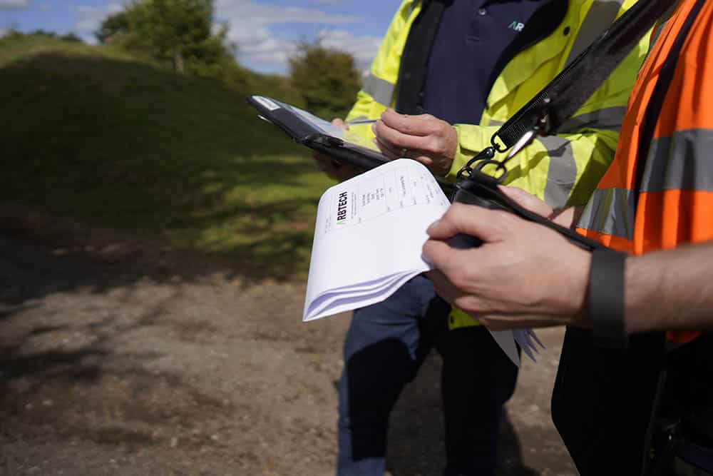
As soon as you give us confirmation that you would like to move forward, we will avoid delays by arranging a date for the necessary tree surveys. Our team – arrived on time and with all of the required equipment – will then make sufficient checks for a good service and leave the site with the information needed to draft up a tree report, helping you to remove any concern in the eyes of the local council and support planning applications.
Arbtech Consulting Ltd
New Broad Street House
New Broad Street
London
EC2M 1NH

Arbtech are your best asset when it comes to getting planning permission for your project. We cover the whole of the UK and we are waiting to get started on your project...
Get Your Free Quote