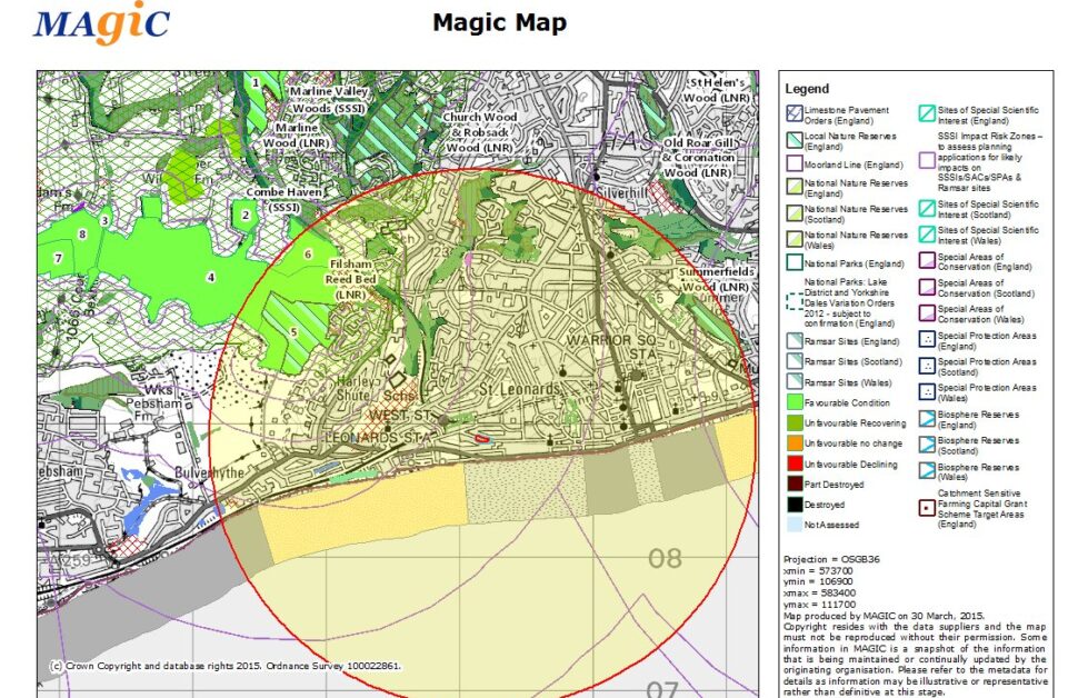
When you get your quotation from Arbtech, it will include a fee element for a biological records data search – normally for a fixed search radius around your proposal’s boundary.
The data search is part of a desk study that is conducted by Arbtech and is an integral part of the ecological evaluation of the site. The data search seeks to obtain existing biological records of protected sites and protected and other notable species from the appropriate Local Biological Record Centre. The fee element in our quotation is made up largely of the external cost of obtaining the data from the records centre and a very modest administration fee from us for the applying for and processing of the data.
Often clients ask us whether the data search is a necessary element of the survey and the answer frankly is yes it is!
If we submit a report without the desk study element there is a likelihood that it will be rejected by the Authorities.
The reasons for this are it is part of the industry standard that is expected by your Regulators (Local Planning Authority, Statutory Nature Conservation Organisation, Environment Agency etc.). For Preliminary Ecological Appraisals (PEA) the “industry standard” has been clearly set out in the Chartered Institute of Ecology and Environmental Management (CIEEM)’s Guidelines for Ecological Appraisal (April 2013).
The guidelines state:
“Desk Study.
The following information sources should be consulted. Obtaining data through desk study will help to determine not only the geographical scope of the survey but also the features to be searched for. Data obtained from these sources should be fully referenced and used in compliance with the terms and conditions relating to its commercial use.
- National – MAGIC and NBN Gateway websites;
- Local – Environmental Records Centres (ERCs), County Councils, Unitary Authorities etc.; and
- Local wildlife groups, e.g. mammal, herpetofauna, bat or botanical groups.”
Furthermore the guidelines give specific advice on the scope of the desk study that will be judged as appropriate and reasonable:
“When identifying the extent of the area under consideration within the desk study, the following should be considered:
- Rather than set prescribed distances or other parameters, the scope and area that should be considered for study should be based on the professional judgment of the ecologist leading the Appraisal. It will depend on many factors (see further below), including: the characteristics of the site subject to appraisal, its surroundings and the nature of the changes proposed. It is therefore essential that both the basis for the decision as to the scope and area of the appraisal is clearly set out and fully justified, and, any assumptions or limitations are described, so that decision makers and consultees can understand the basis of the appraisal and consider whether it is adequate for the stated purpose.
- Records for notable and/or protected species within 1 – 2 km are usually considered to be of greatest relevance within most studies. In other cases, such as for small sites with limited ecological interest and localised effects, a smaller search area may be appropriate (such as within 500 m). Ecological judgement should dictate where various ecological/ habitat factors indicate that this distance should be increased: such as habitat connections to site, e.g. where otters have been recorded via fluvial networks, or potential for visiting flocks of notable birds where suitable habitats exist within the survey site, or important flight routes between the site and bat roosts (see example involving greater horseshoe bats Rhinolophus ferrumequinum on page 25 of Bat Mitigation Guidelines – MitchellJones 2004).
- Attention should be focussed on connections between the survey area and nearby habitats, especially aquatic habitats and wetlands both upstream and downstream via fluvial networks or other hydrological networks. Potential effects within the water table should also be considered e.g groundwater dependent raised bogs and other groundwater dependent wetlands. Connections may also exist between a site and mineral workings which could depress the water table for some distance around them e.g. wet sand and gravel workings.”
The PEA guidelines are emphasised in the 2013 British Standard BS 42020:2013 Biodiversity — Code of practice for planning and development. The Standard states:
“6.4.1 Survey methods should follow good practice guidelines and, where undertaken, preliminary ecological appraisals (PEAs) should be conducted in accordance with the CIEEM Technical Guidance Series Guidance for Preliminary Ecological Appraisals
6.4.2 Where available, local record centres (LRCs) or other appropriate data providers should be approached initially for species and habitat information to inform desk studies. The data generated through desk studies should be properly analysed and interpreted, with the results used to inform fieldwork and further assessment of the development proposal. Only the main findings and conclusions from desk studies should be provided with the ecological report, with the full results of the desk studies available on request.”
These are the standards that your proposal reports will be judged by and I re-iterate my earlier comment that these are not a “nice-to-do” element or unnecessary “gold-plating” but essential elements of your ecological evaluation. Our ecologist will interpret the local record data along with other material gathered in the desk-study phase to consider whether there is a likelihood of direct or indirect impacts on biodiversity as a result of the project proposals.
Also if we are carrying out a more detailed “Phase II” ecological survey for you such as a bat presence/likely-absence survey; we will normally be obliged to obtain a more tailored set of biological records if they are not already available (such as, for example, a 2km search for known bat roosts and bat species records).
I hope you found this useful, and please do contact me if you have any further questions.
-Chris.

There are no comments yet. Why not get involved?